Before and After: Google Earth Views Show Nine Months of Flagler Co. Progress
Two Google Earth views (Feb. 2016 and Nov. 2016) highlight Flagler County’s rebounding construction sector, driven by a revitalized economy.
February, 19, 2017 – Google Earth has posted several dated views of Flagler County to the Google Earth app., dating back to February 1995. The most recent image dates are February 16, 2016 and November 18, 2016, a nine-month span. A lot can happen in nine months. Check out these Before and After shots as we tour our area. Those who think not much is happening in Flagler County need to get out more.
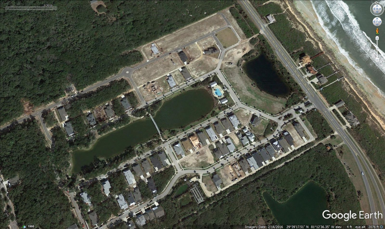
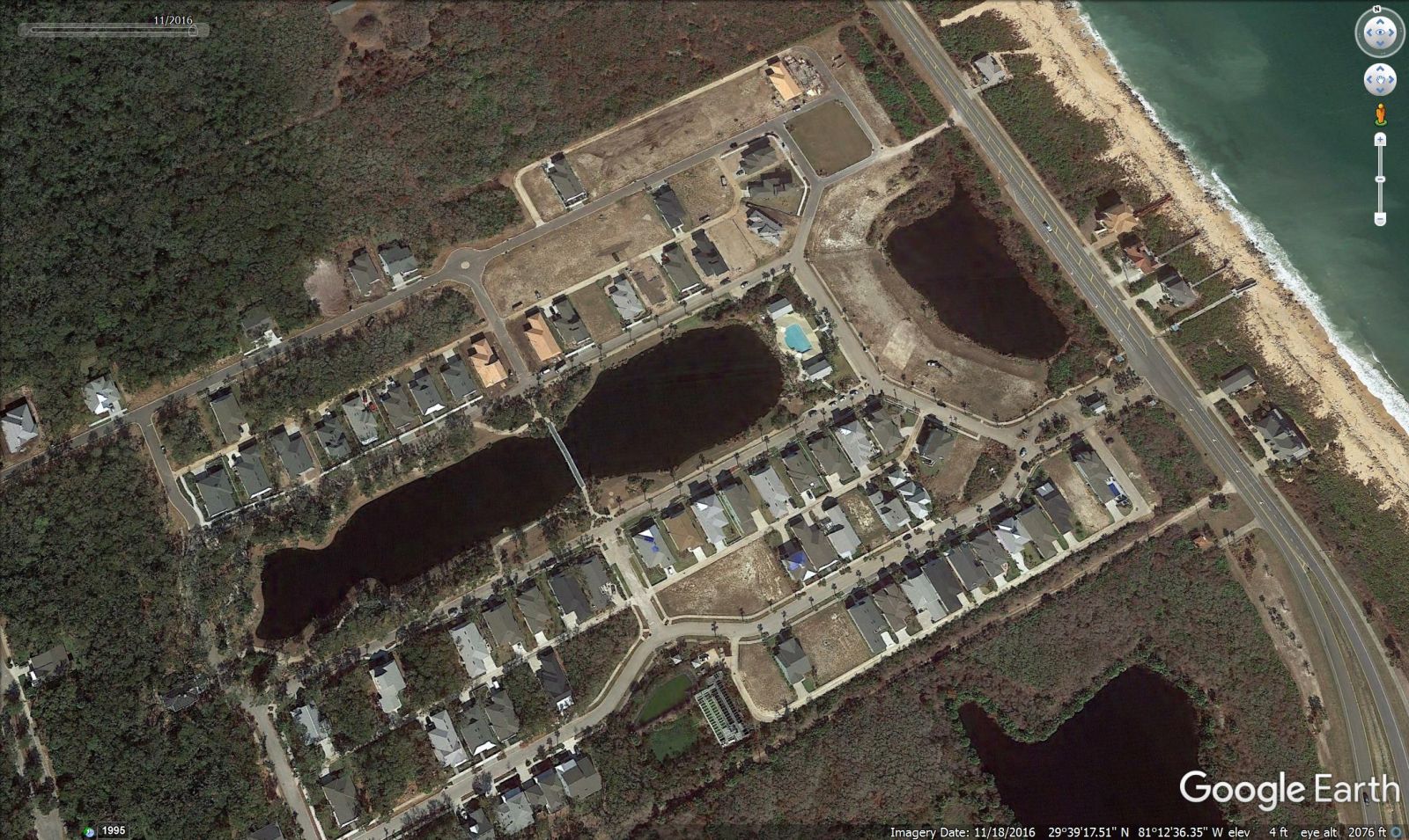
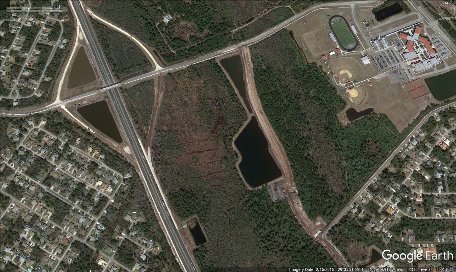
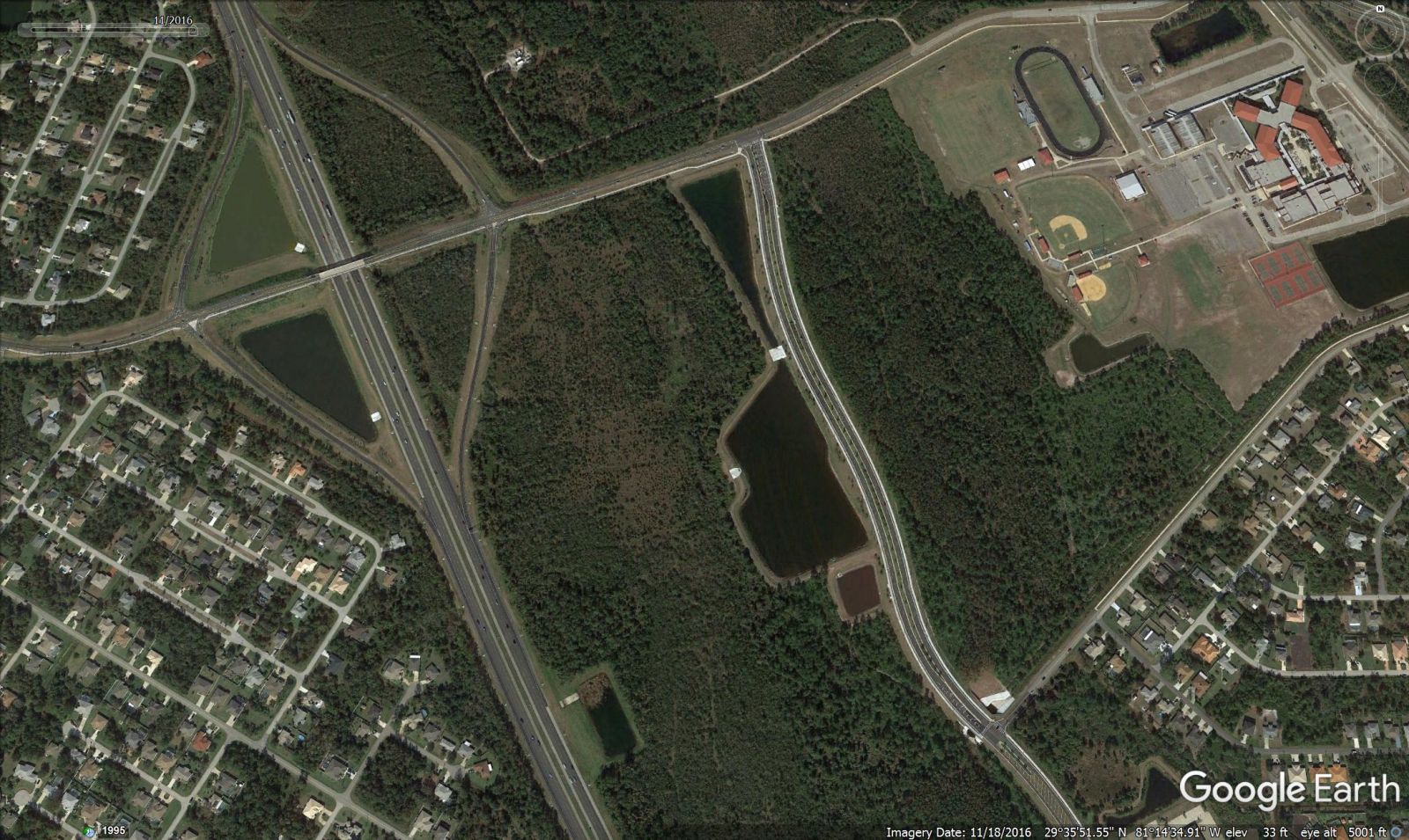
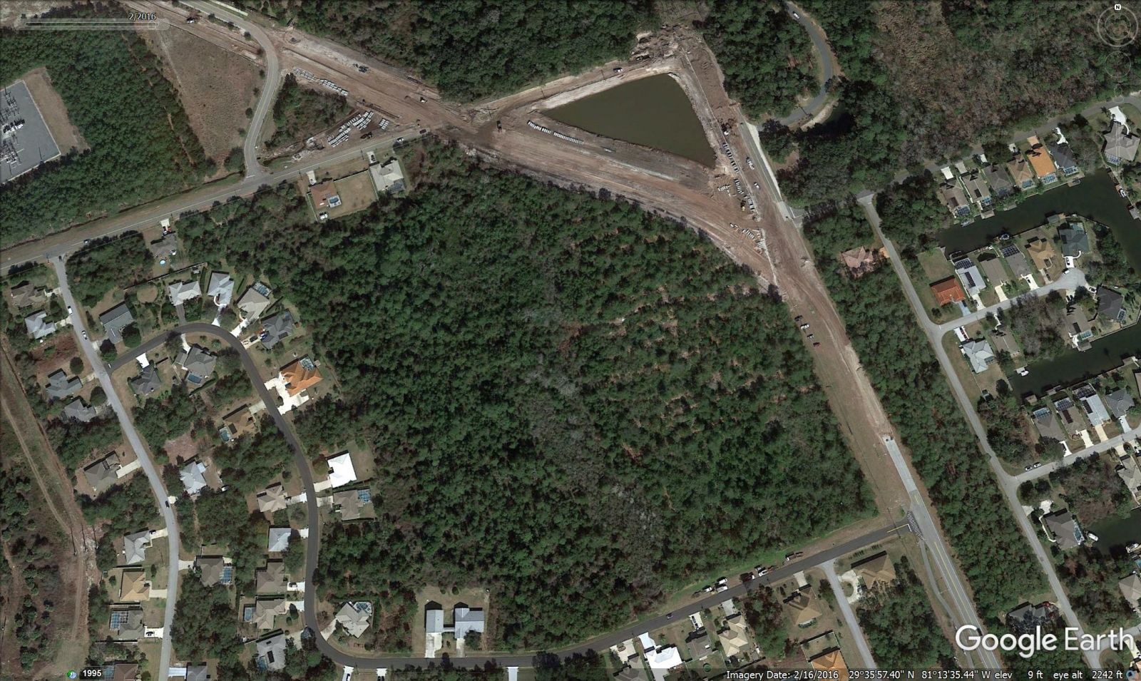
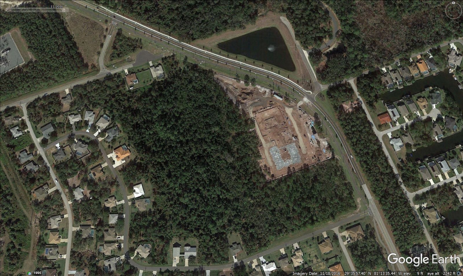
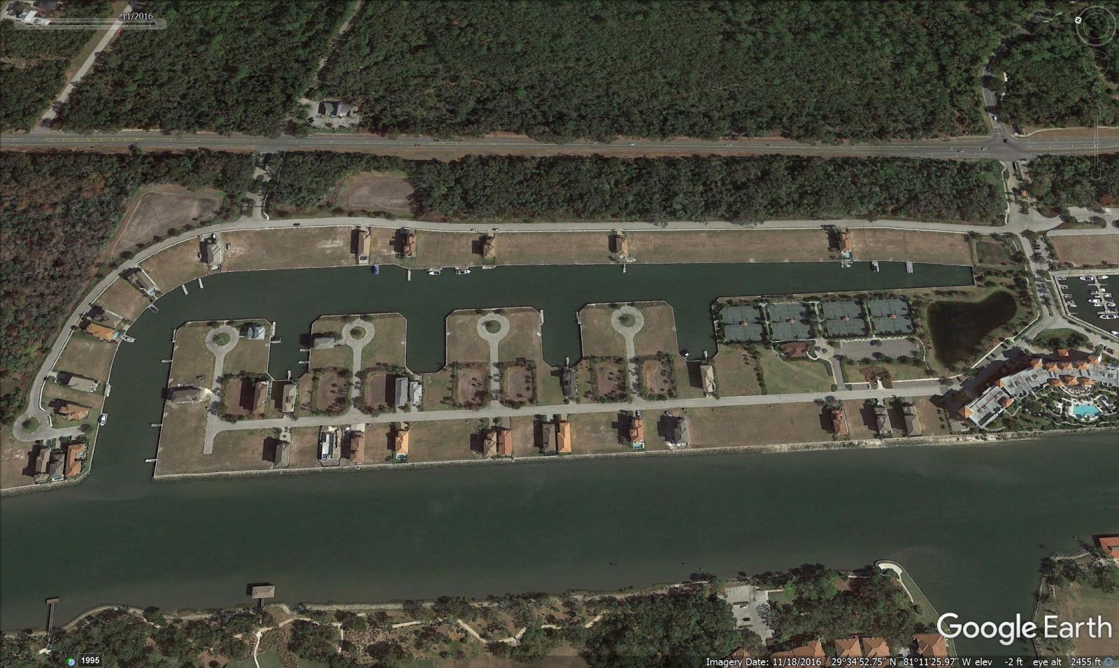
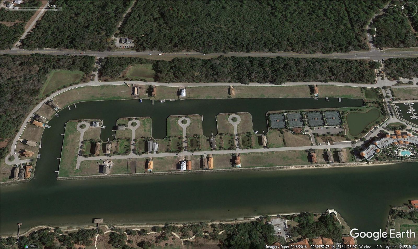
In each of the following image pairs, the one on the left was captured on February 16, 2016. The right-side image is from November 18, 2016.
BEACH HAVEN ON A1A SOUTH OF MARINELAND (Landon Homes)
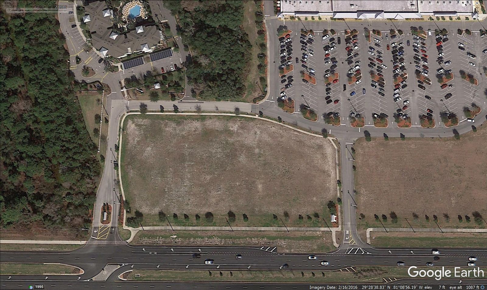
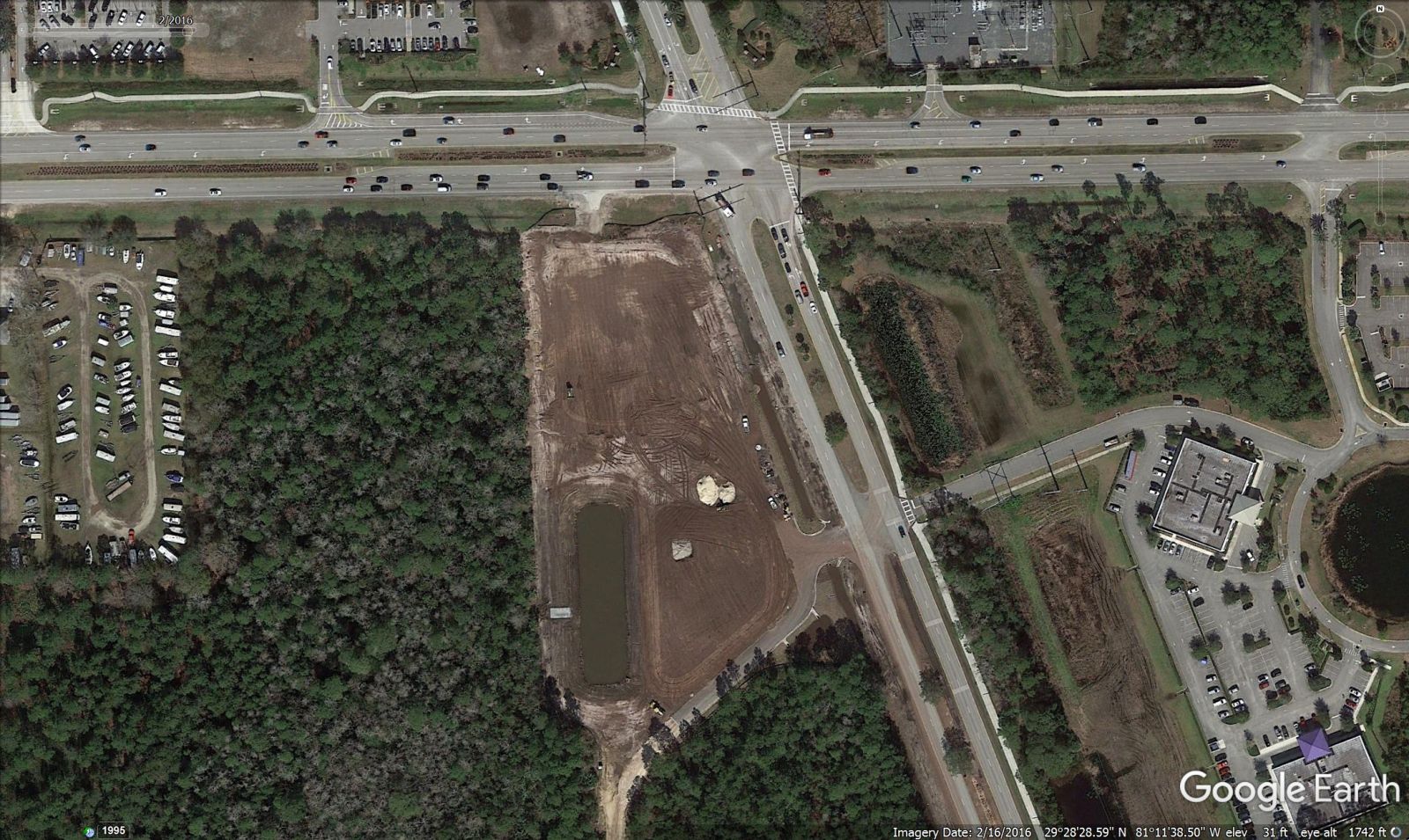
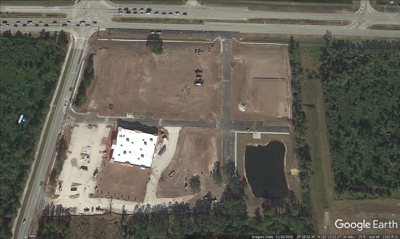
I-95 INTERCHANGE AT MATANZAS WOODS PKWY AND OLD KINGS RD EXTENSION
PALM HARBOR EXTENSION AND PROTEA SENIOR LIVING – SABAL PALMS
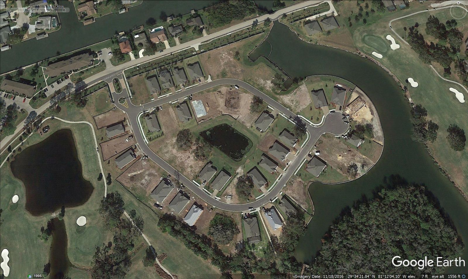
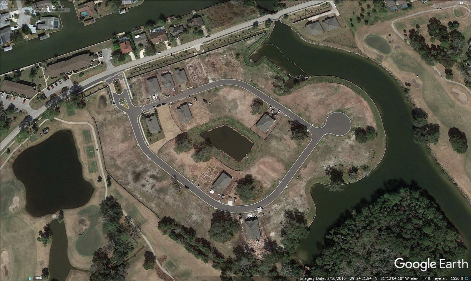
YACHT HARBOR VILLAGE (Not that many new homes, but these are expensive homes that take longer to build)
COUNTRY CLUB HARBOR (DR Horton)
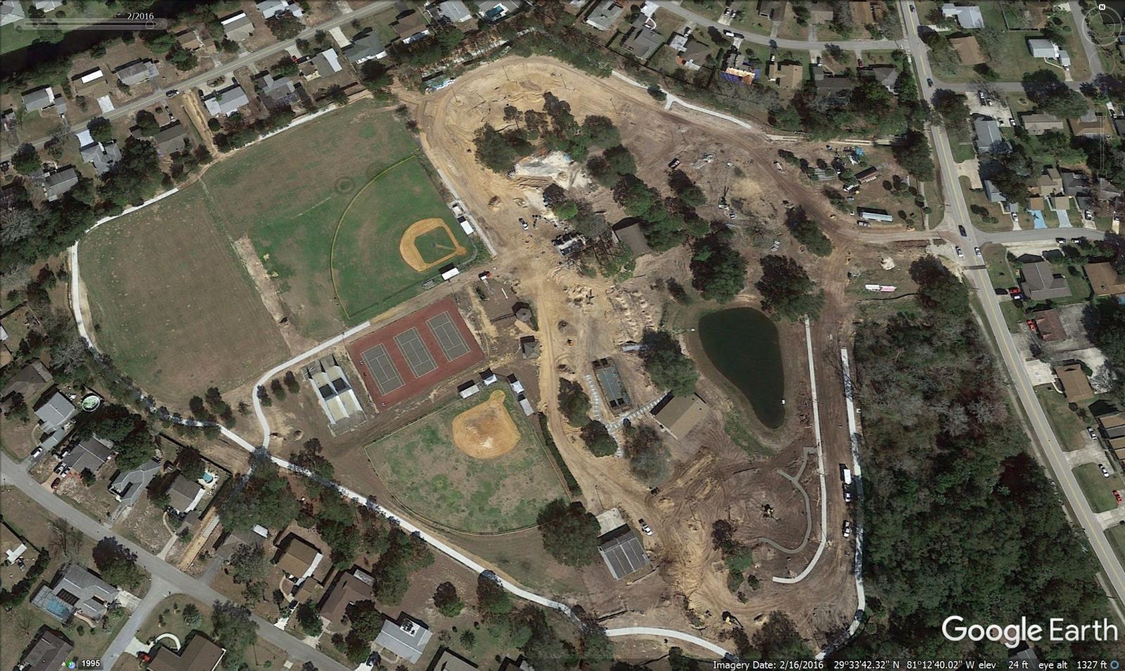
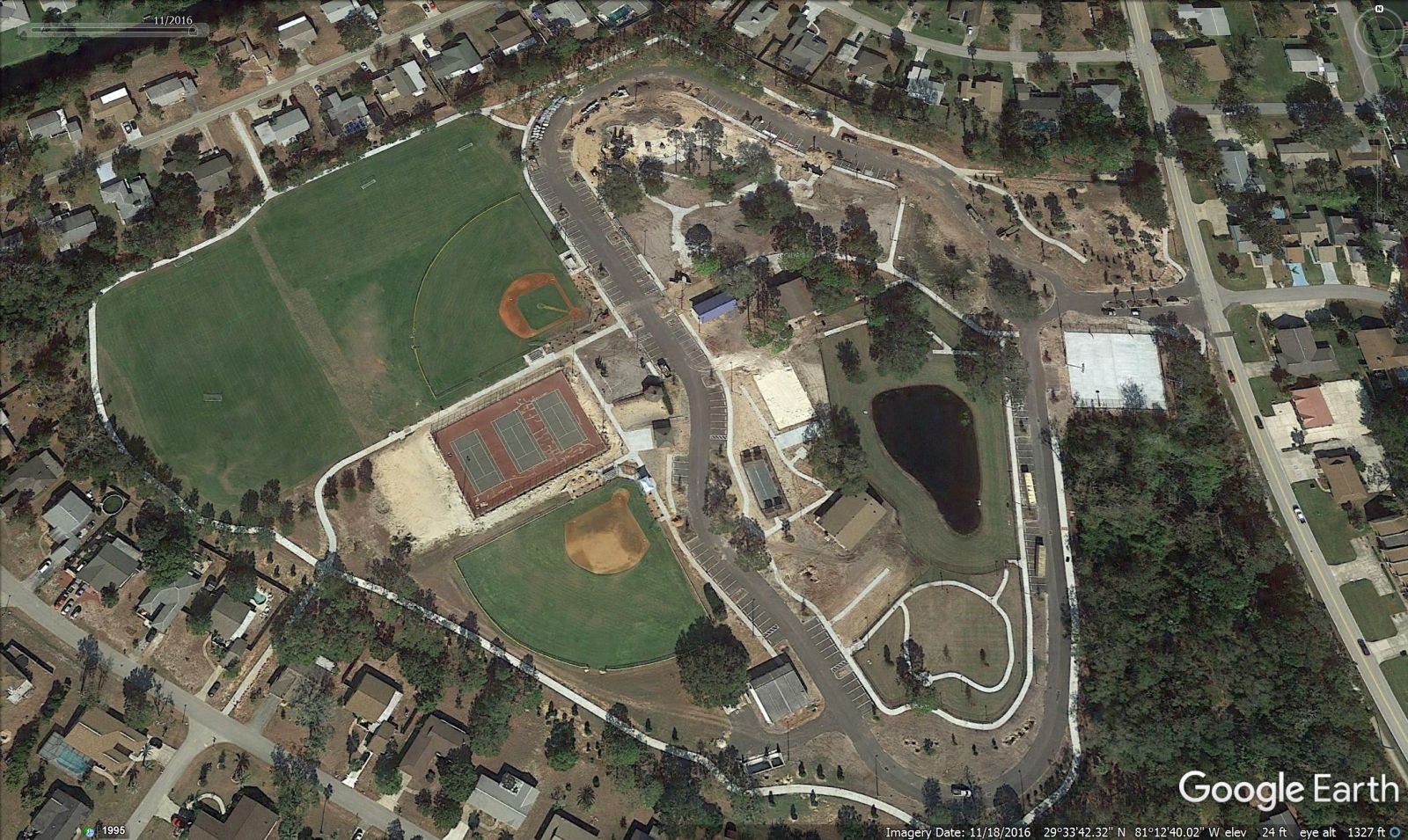
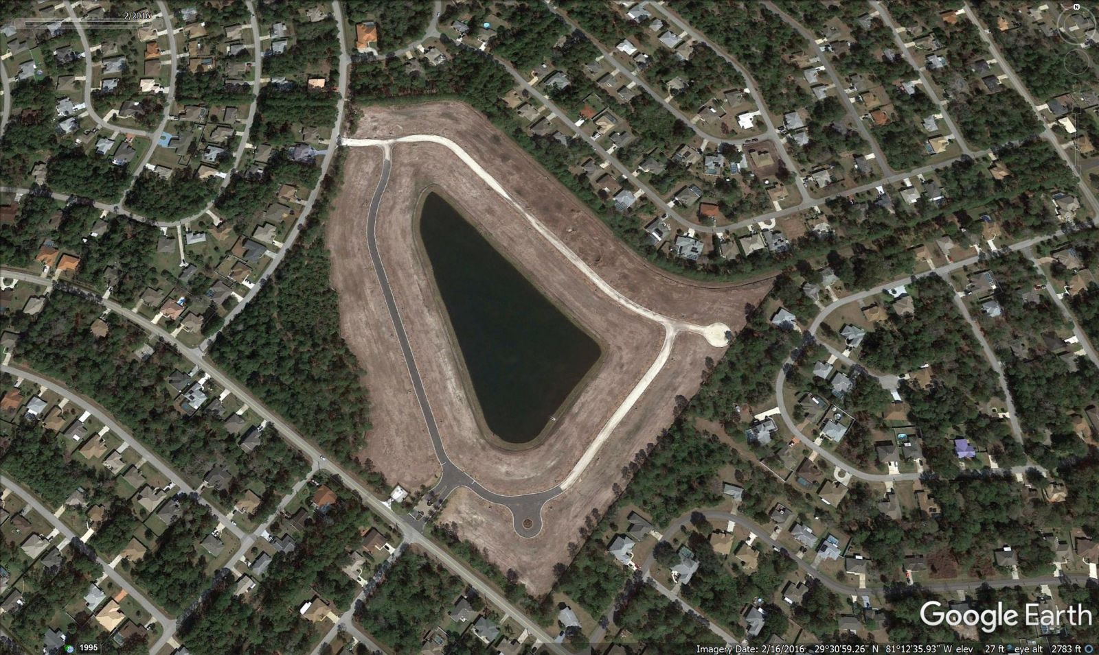
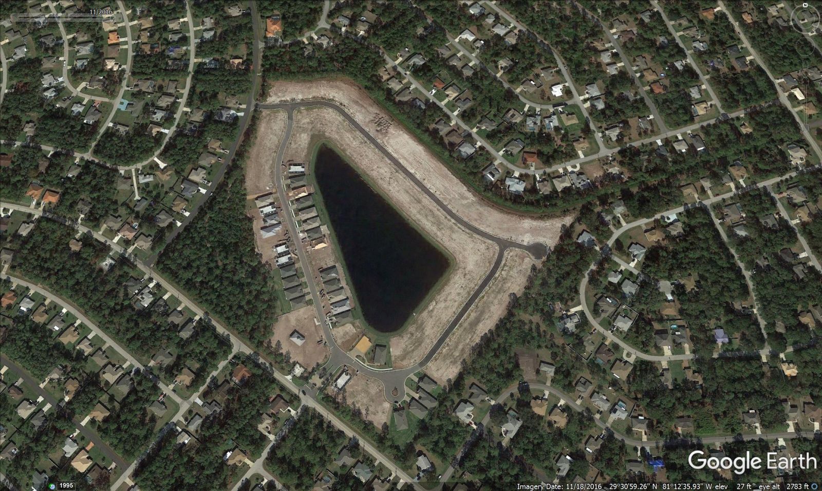
HOLLAND PARK (nine months time lapse, about nine months behind schedule)
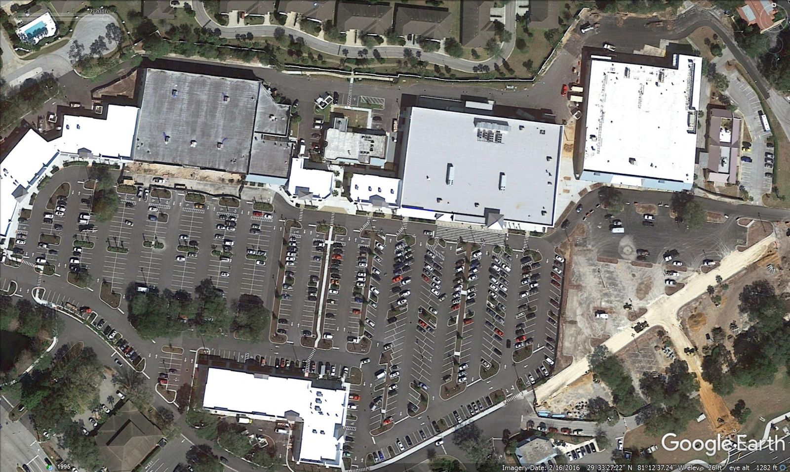
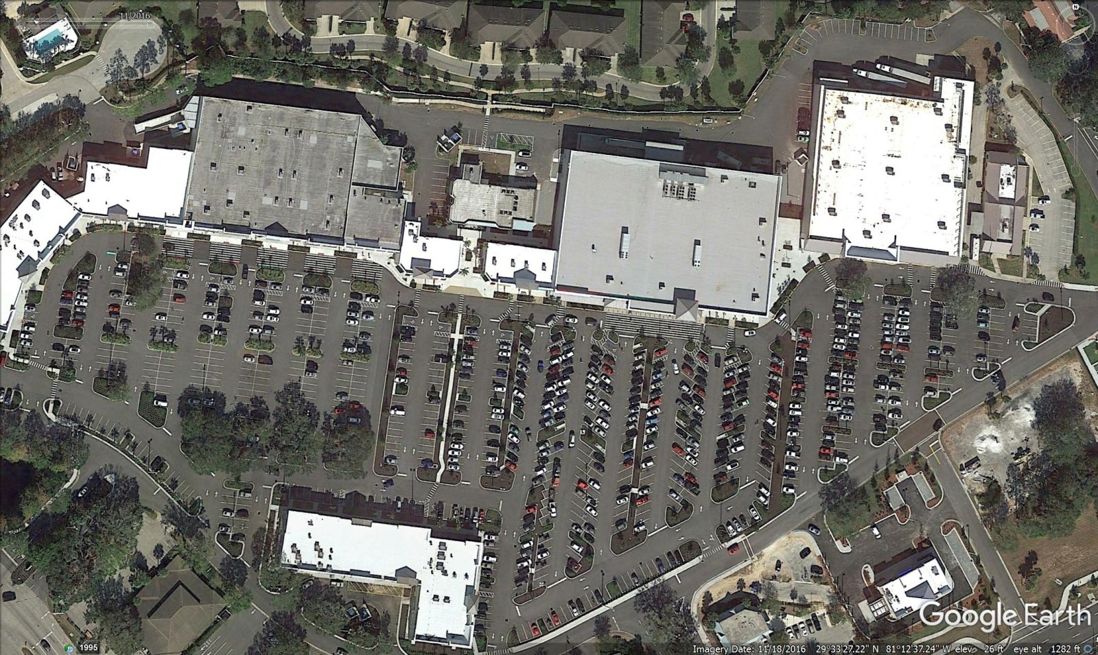
ISLAND WALK – CHASE BANK, HOBBY LOBBY IS OPEN
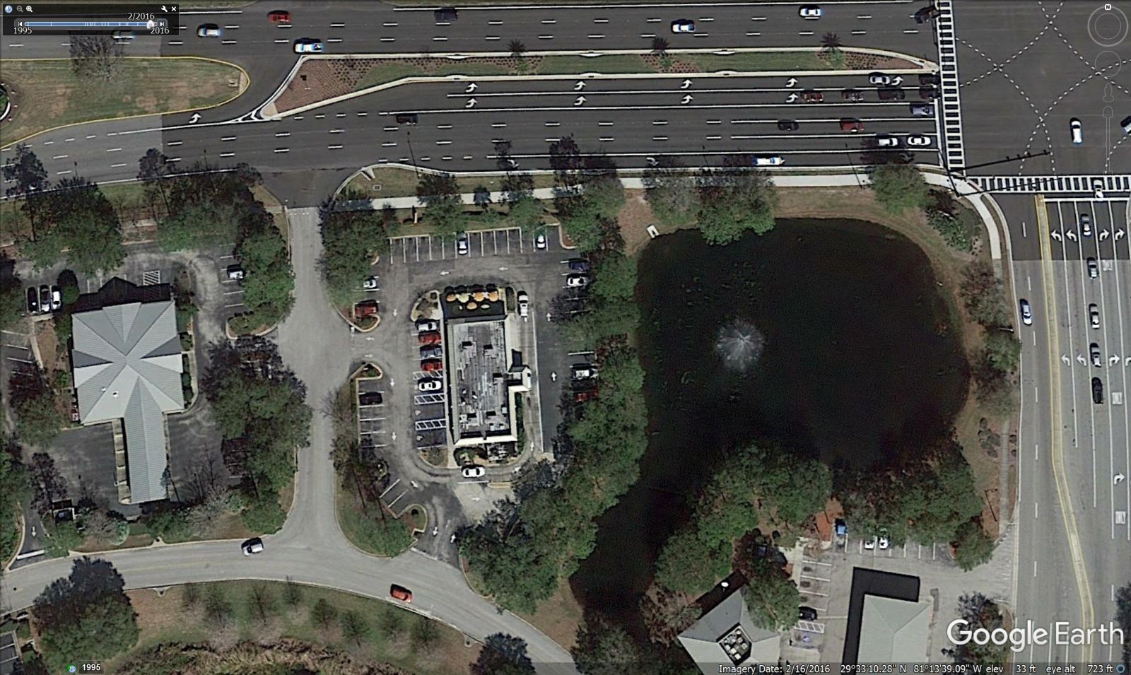
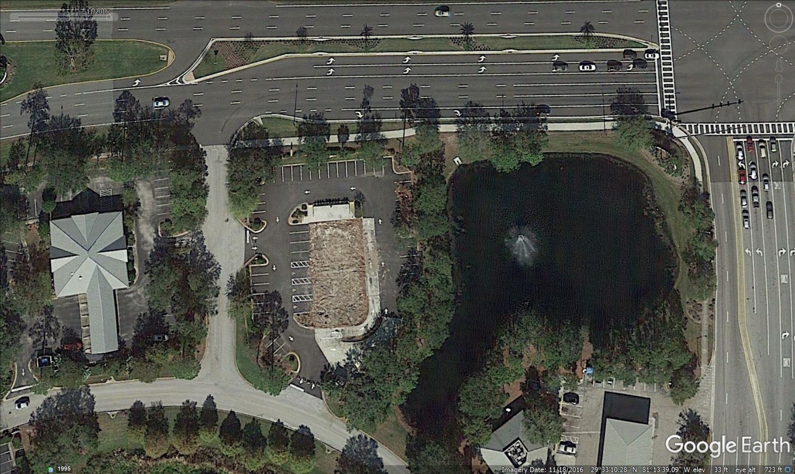
DUNKIN DONUTS BEFORE AND AFTER THE FIRE (Replacement is under construction)
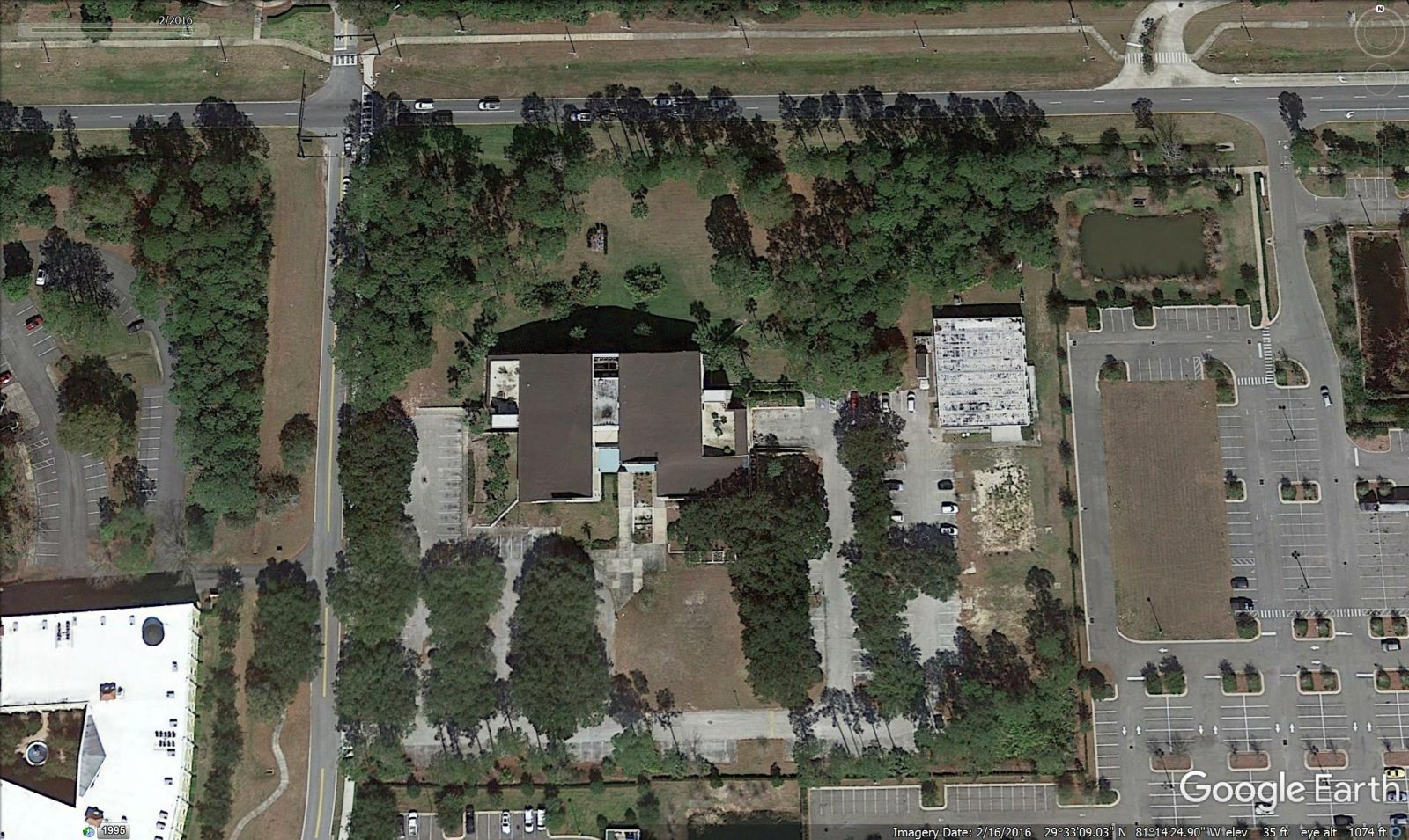
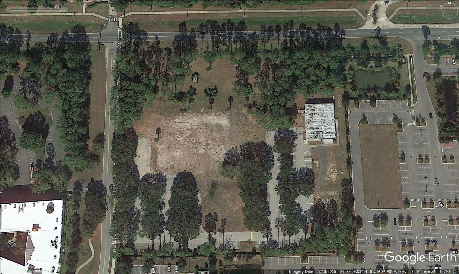
ITT BUILDING – TORN DOWN FOR SOMETHING NEW
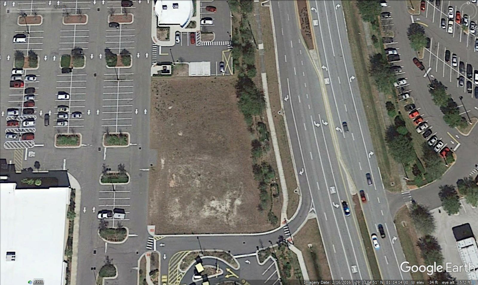
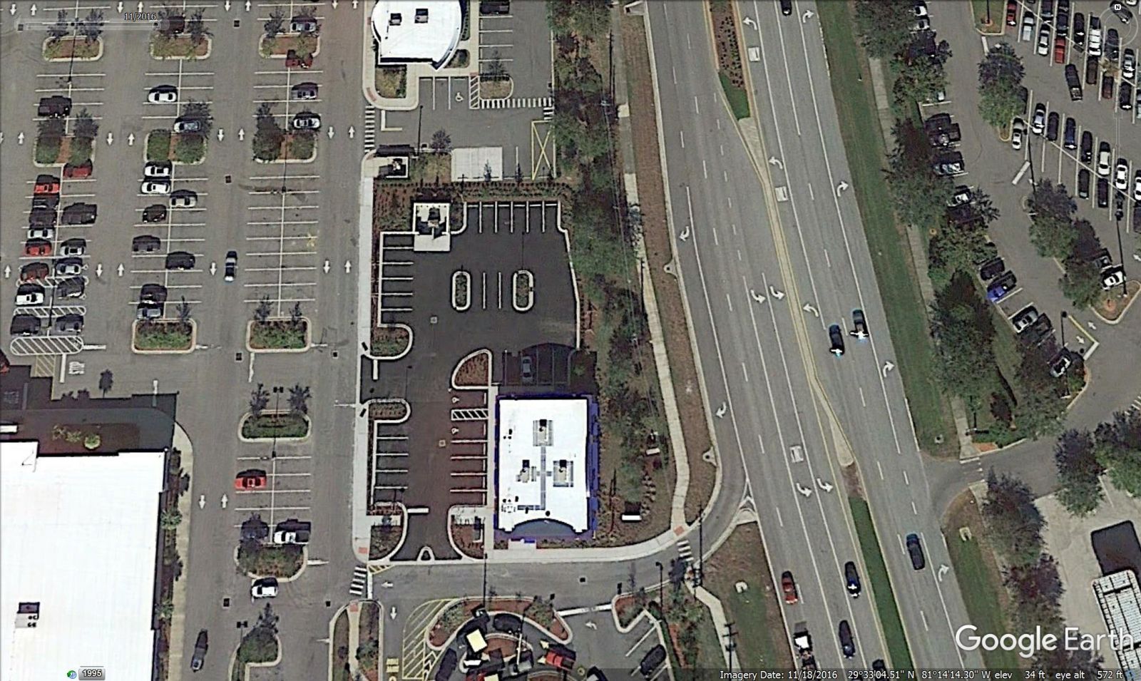
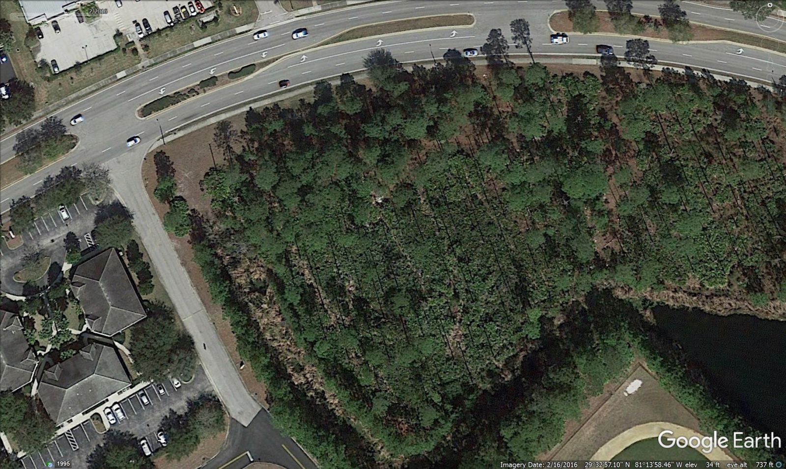
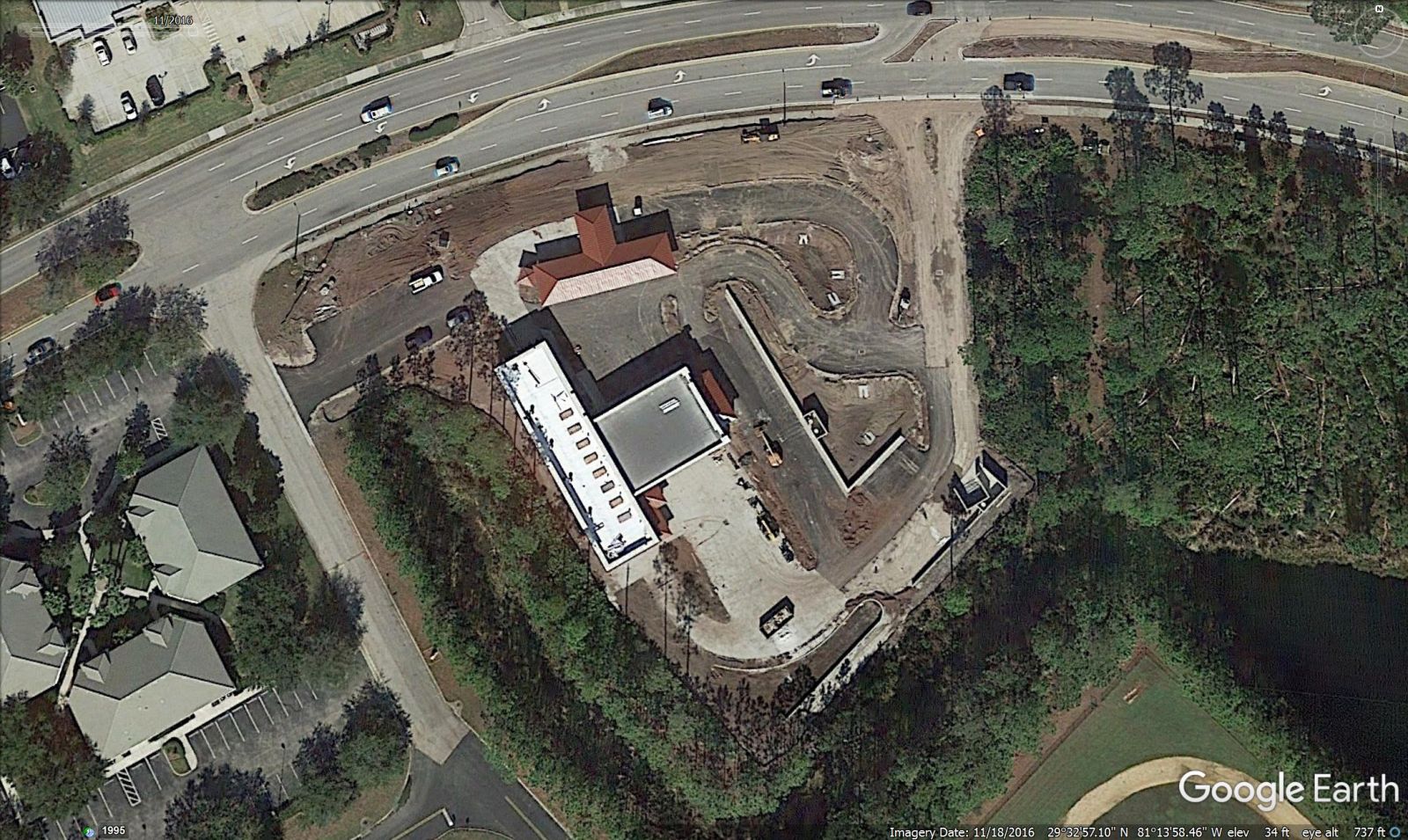
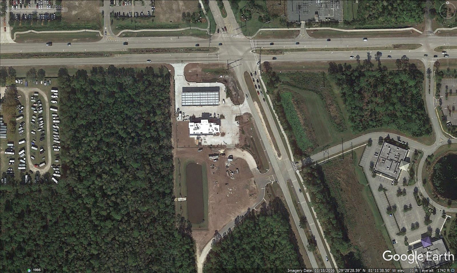
ASPEN DENTAL
PARK PLACE (Seagate Homes, Holiday Builders)
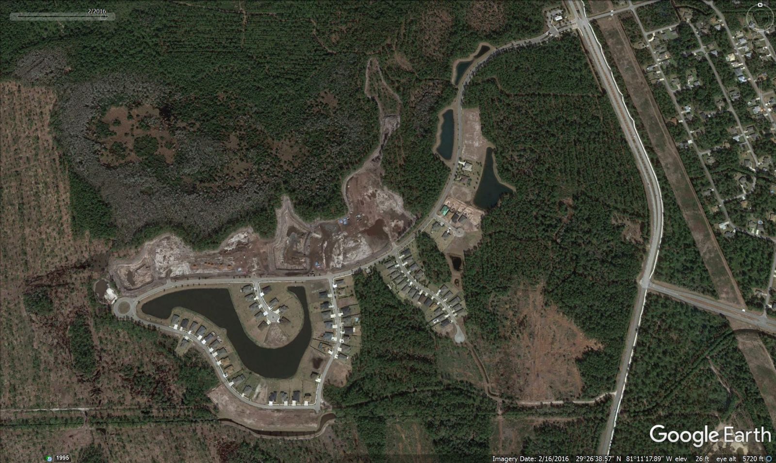
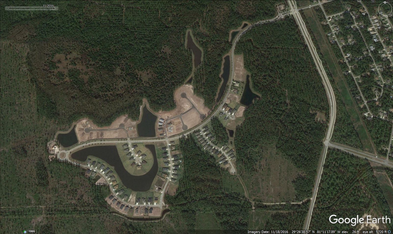
HIDDEN LAKES (Paytas Homes)
SUPERWASH CAR WASH
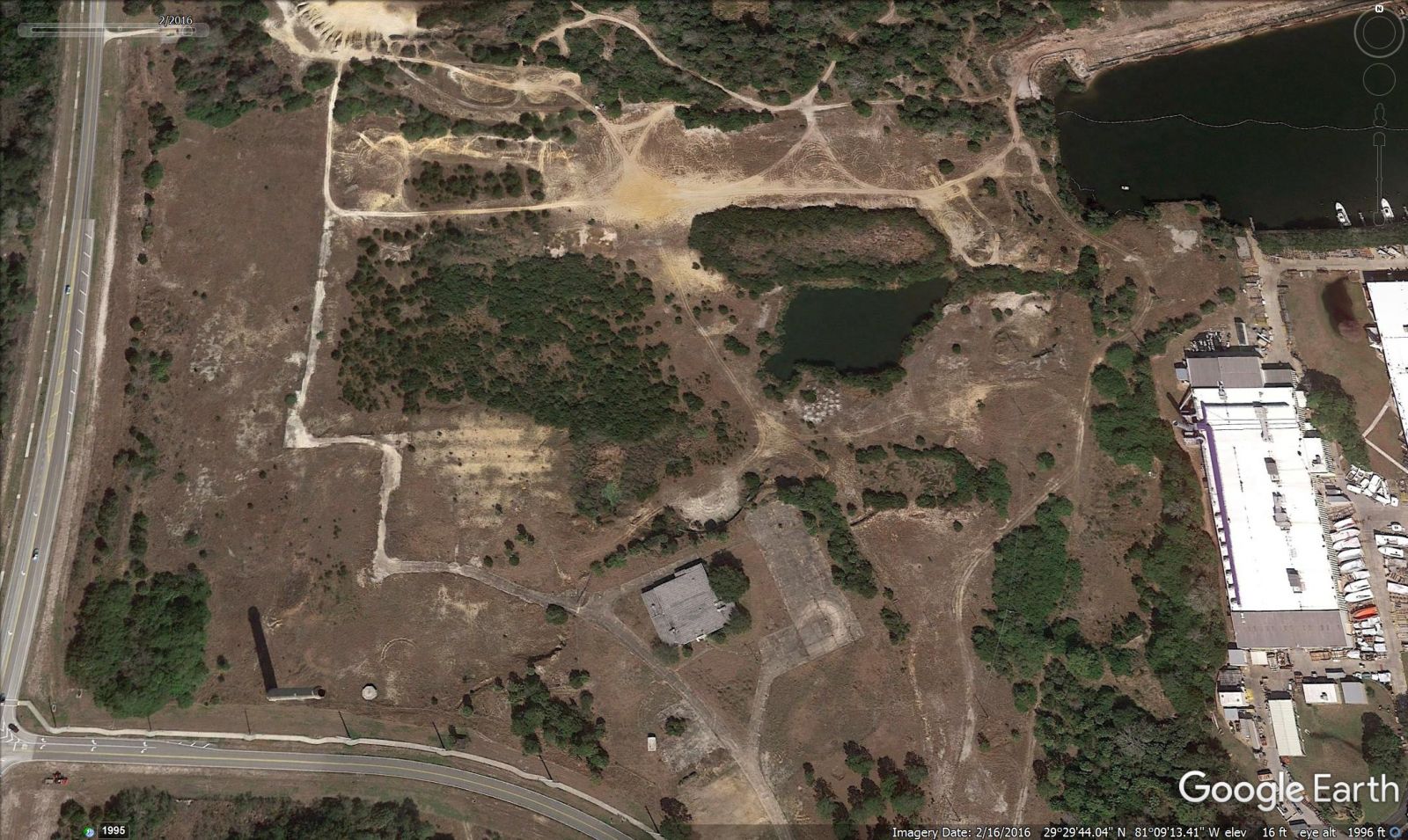
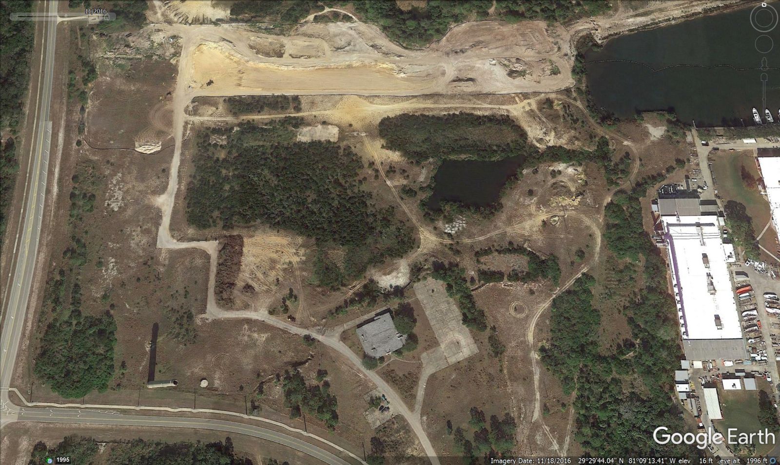
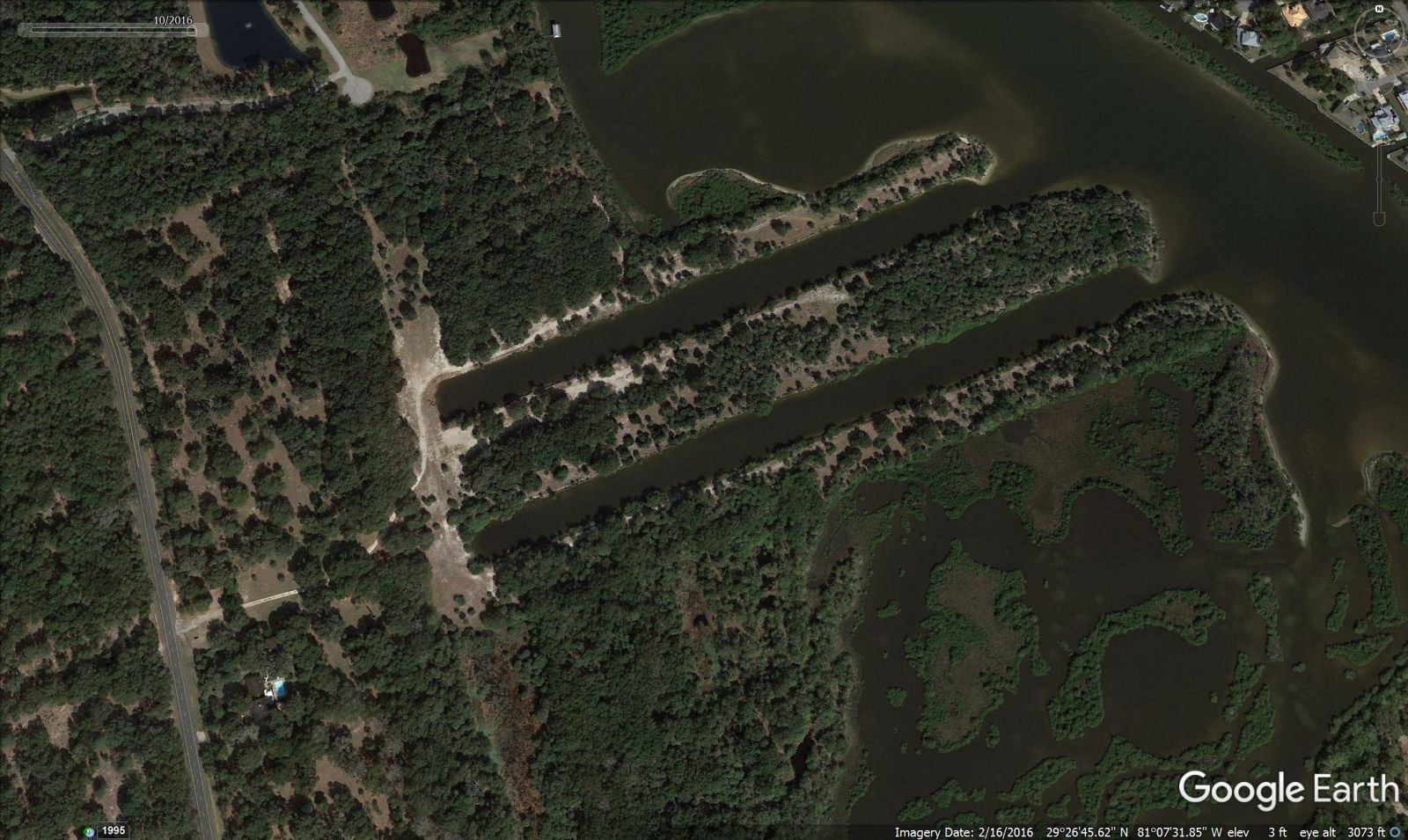
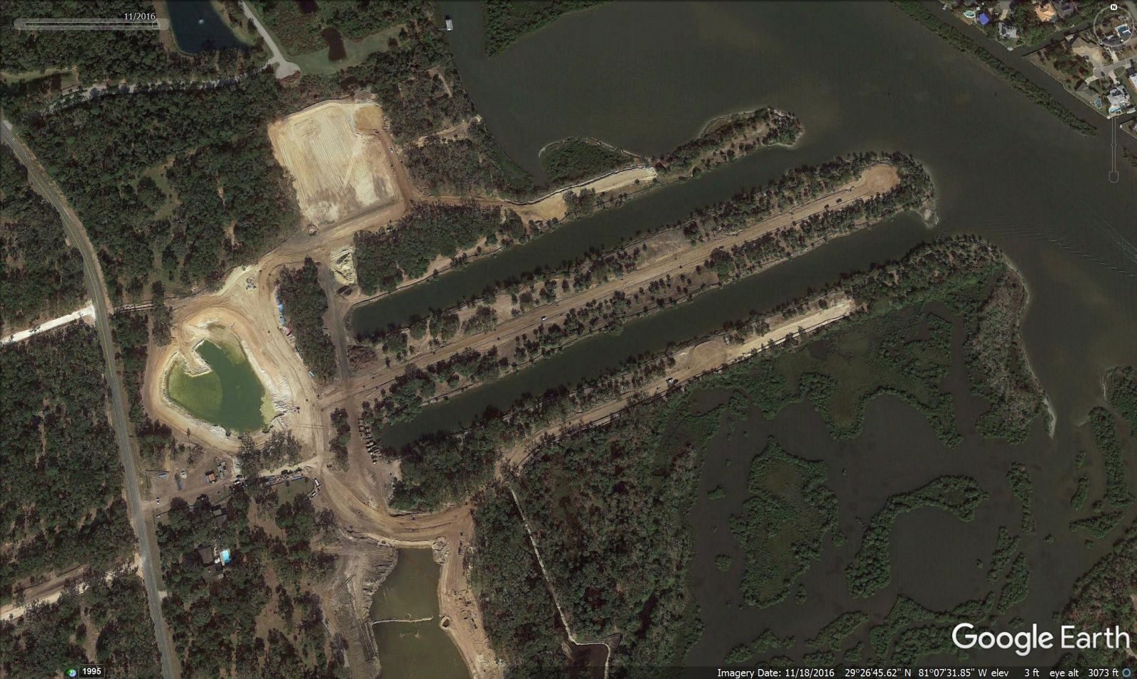
LIGHTHOUSE HARBOR MARINA (Old Lehigh Cement Plant location)
SEASIDE LANDINGS (Formerly Bulow Shores on John Anderson)
BEACH VILLAGE 7-ELEVEN
.jpg)
SR 100 RACETRAC
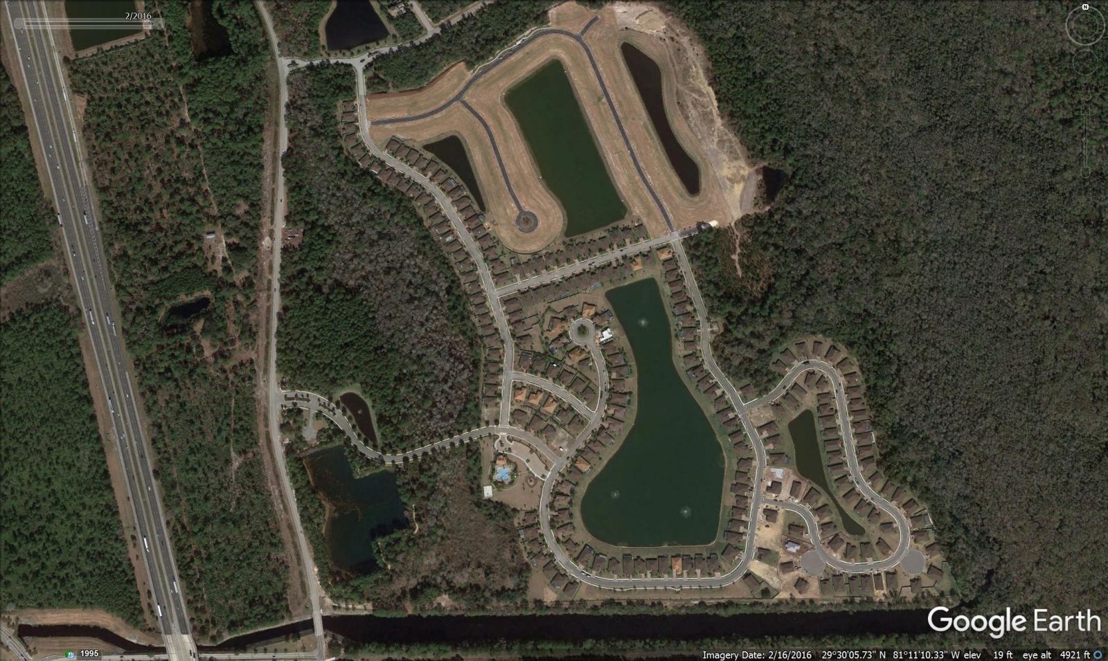
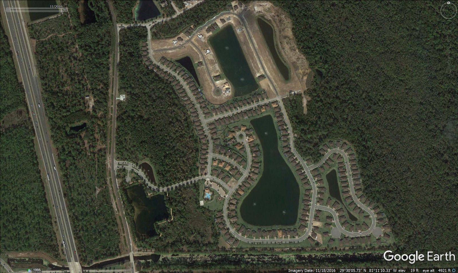
GRAND LANDINGS (Dream Finders, DR Horton
SHOPPES OF PALM COAST (Tractor Supply Co. Aldi and Starbucks coming soon)
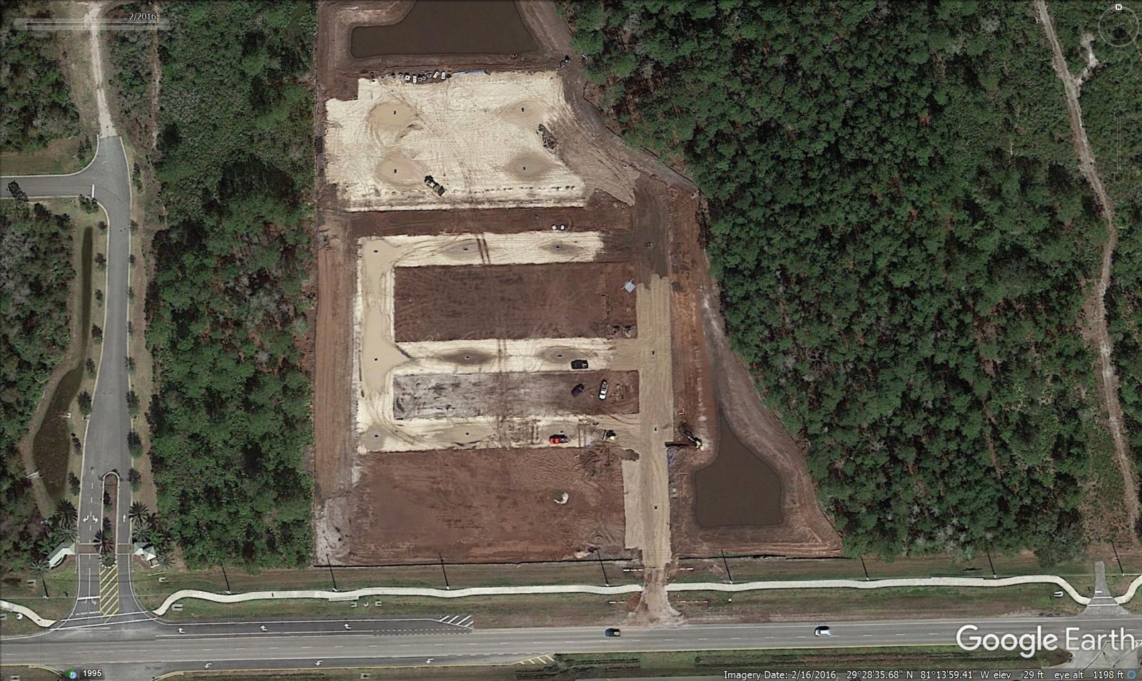
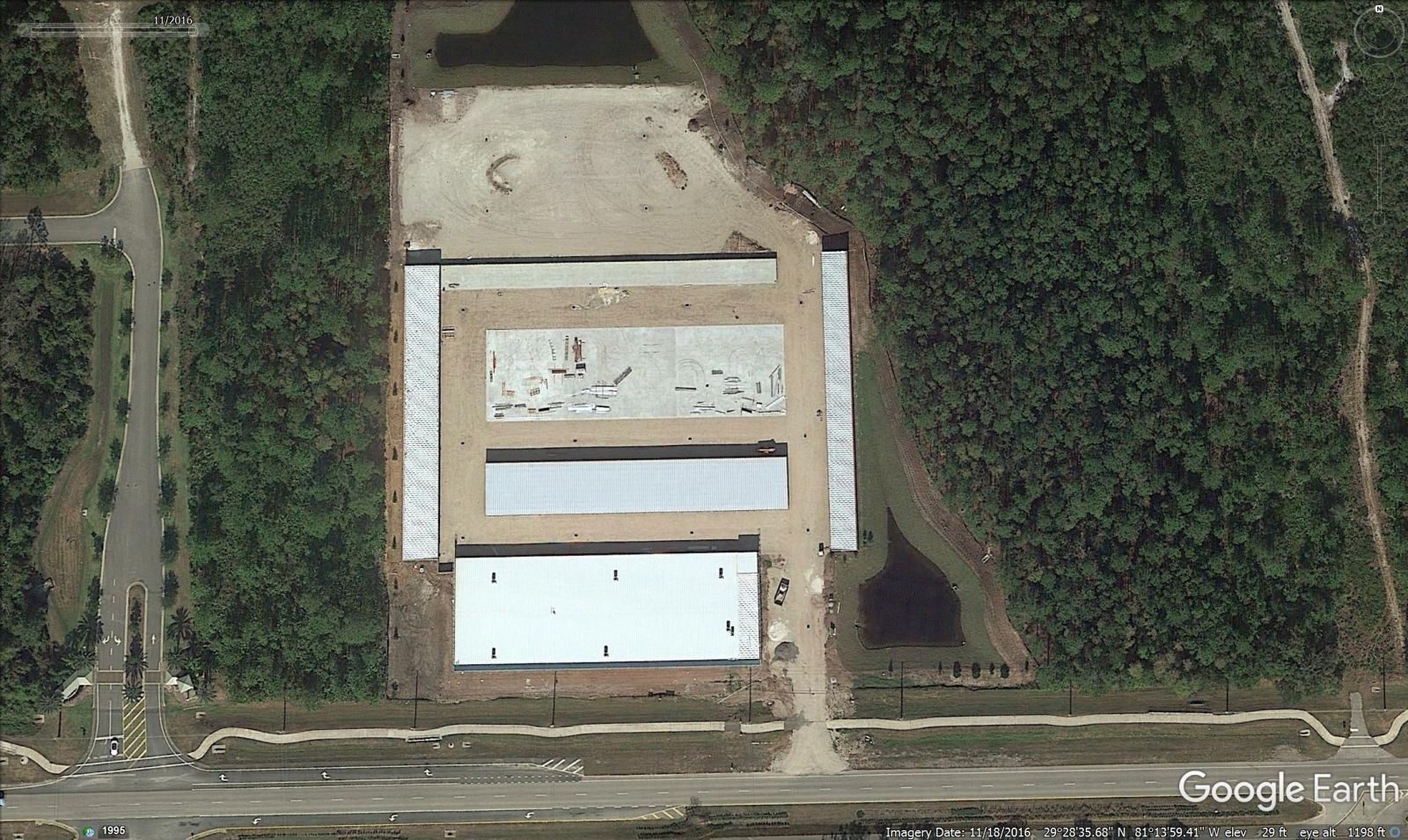
STOR-IT SELF STORAGE (SR 100 in Bunnell)
Impressive, don't you think?
Leave a Reply
Want to join the discussion?Feel free to contribute!